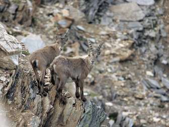
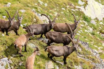
The viaCapricorn mountain hike leads in three daily stages through the federal hunting ban area of Beverin - right through the middle of the Safien-Rheinwald ibex colony.

The viaCapricornis a challenging mountain hike that takes you from Wergenstein in three one-day stages through untouched Alpine landscape right through the heart of the Safien-Rheinwald ibex colony with its 350 or so animals.
The hiking trail is signposted throughout with the number 693 as a regional route of Hiking in Switzerland and marked in red and white.
Experienced hikers should allow around 5-7 hours for each stage. The ascent to Alperschälli at the start of the third hiking stage in particular requires surefootedness. The viaCapricornis not suitable for small children.
Due to the current snow conditions, we do not recommend this hike. There is no trail maintenance during the winter season!
From the Center da Capricorns you hike through the Wergensteiner pastures to the Maiensäss Dumagns with its typical small wooden huts and the associated larger stables.
Continue towards Piz Beverin through meadows and the alder-covered pastures of the Val da Larisch, the habitat of the black grouse, to the stream.
From there, follow the signs across the mountain meadows up to the Alp Tumpriv parking lot (Pt. 2114). From there, the viaCapricornleads to Alp Tumprivand across alpine meadows to the hiking trail to the Carnusapass. With a bit of luck, you may see ibex for the first time here, as well as chamois, ptarmigan, mountain hare...
From the Carnusapass, the hiking trail leads past the turquoise-colored Lai la Scotga (Romansh for Scotsman Lake; Scotsman is the cheese by-product, also known as whey or sirte), which is ideal for a break.
After crossing the Carnusabach stream, the trail continues to the Tritthütte (Pt. 2318) and continues uphill to the left of it. Before the Mittler Hütta (Pt. 2097), the path turns off and leads down to the Under Hütta/Carnusahütte (Pt. 1653). Around 25m after the Under Hütta, the hiking trail turns right down the valley to the bridge over the Carnusabach (Pt. 1587).
After a short climb, you reach your destination for the day, the Beverin inn in Usser Glas.
Recommended start time: 08.00 am
| Wergenstein - Dumagns | approx. 1 hour |
|---|---|
| Dumagns - Alp Tumpriv | approx. 1 hour 30 minutes |
| Alp Tumpriv - Carnusapass | approx. 1 hour 30 minutes |
| Carnusapass - Tritthütte | approx. 1 hour |
| Tritthütte - point 1587 | approx. 1 hour 30 minutes |
| Point 1587 - Glass pass | approx. 45 minutes |
| Total | approx. 7 hours 15 minutes |
From the Beverin restaurant, follow the road to the Walser settlement of Inner Glas.
Now follow the steep path through the forest on the edge of the Carnusatobel to Safien Platz, where you reach the valley floor directly below the equalization basin of the Zervreila power plants.
Follow the equalizing basin for a few metres and turn right immediately after the Rathaus inn. Once you reach the Safier valley road, follow it into the valley for approx. 5 minutes. A hiking trail leads off to the right and climbs steeply up to Hof . From Hof, follow the road until shortly before Camanaboda. There the hiking trail leads away from the road to the picturesque Walser settlement of Camanaboden with its typical wooden houses.
In Camanaboda you can also visit the local museum (please book your visit in advance, tel. +41 81 647 11 61 or +41 81 647 11 17).
From Camanadboda, the hiking trail leads off to the right up to the Camaner huts. The trail leads alongside the huts and leaves them slightly downhill across alpine meadows and through the Camaner forest to the Bächer huts.
The trail leads through the Bawald forest down to Thalkirch. You walk past the Thaler Kirchlein church down to the stream and follow it to Turrahus.
Recommended start time: 09.30 am
| Glass passport - Inner Glas | approx. 30 minutes |
|---|---|
| Inner Glas - Safien Platz | approx. 1 hour |
| Safien Platz - Court | approx. 1 hour |
| Court - Camanaboda | approx. 45 minutes |
| Camanaboda - Thalkirch | approx. 1 hour 30 minutes |
| Thalkirch - Turrahus | approx. 30 minutes |
| Total | approx. 5 hours 15 minutes |
From Turrahus you hike along the valley floor to Piggamad .
Now follow the steep mountain trail in the direction of Alperschällilücke. The ascent through the Höllgraben to Alperschälli is steep and challenging and requires surefootedness. Once you have climbed the Höllgraben, you reach the Alperschälli. It belongs to the municipality of Safien, but has always been farmed by the farmers of Schams, as it is easier to access from the Schams side. In the summer months, there is a good chance of spotting ibex here. Now follow the path a little way towards Alperschällilücke and then turn left (signposted via CapricornRoute 693) to cross the Alperschälli to the north and climb up to Farcetta d'igl Lai Grànd.
Accompanied by the sight of the imposing Pizzas d'Anarosa, you hike down into the Schamsertal, past the pearl of the Schamserberg, the mountain lake Lai Grànd with its little brother Lai Pintg through the legendary Alp Anarosa to point 2315, on to Nurdagn and from there via point 2138 over old paths down to the alpine huts of Danis. From there, follow the agricultural road until shortly before Dumagns.
Turn right here to follow an idyllic path for the last few kilometers of the viaCapricornto Wergenstein.
Recommended start time: 08.00 am
| Turrahus - Piggamad | approx. 1 hour |
|---|---|
| Piggamad - Fta. d'igl Lai Grand | approx. 2 hours 15 minutes |
| Fta. d'igl Lai Grand - Lai Pintg | approx. 45 minutes |
| Lai Pintg - Danis | approx. 1 hour |
| Danis - Wergenstein | approx. 1 hour 30 minutes |
| Total | approx. 6 hours 30 minutes |
Mountain hiking trails are usually narrow and often steep. Therefore, please note:
Requirements: good physical condition and preparation; you must be able to correctly assess the conditions and dangers (weather). Sure-footedness and a head for heights are important on exposed sections.
Equipment: sturdy hiking boots with a non-slip sole, weatherproof and warm clothing, rain protection, food and sufficient water, sun and head protection, first-aid kit, maps, possibly telescopic poles.
Viamala Tourism
Bodaplatz 4
7435 Splügen
Tel. +41 81 650 90 30
info@viamala.ch
www.viamala.ch
