Source of the Hinterrhein

The water already has many meters of altitude behind it at the village of "Hinterrhein" and another 1600 meters of altitude ahead of it to the North Sea. And this on a journey of 1200 kilometers.
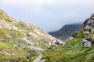
The source region of the Hinterrhein can only be reached on foot. The hike requires a head for heights, sure-footedness and sturdy footwear. As the path from Hinterrhein leads over the shooting range, it is necessary to find out about shooting operations and possible access times the day before. There is usually no shooting at weekends. Depending on the operation, transportation to the end of the shooting range is also possible for a fee. It is best to organize this directly with the hut warden at the Zapporthütte. From the Zapporthütte it takes about an hour's walk to reach the headwaters of the Hinterrhein. You can also spend the night in the Zapporthütte.
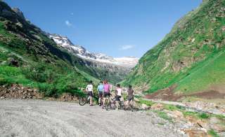
The Grischa mountain sports school offers guided tours to the spring area and the Rheinquellhorn.


Prices:
Address
Contact us


Report error (ID: 03be879e-0e4d-49fc-913e-79c0379db163)